Bariera Vergului, the Place Where Bucharest Checked Its Pockets and Went Out for a Picnic
By Eddie Țone
- Articles
- 03 SEP 26
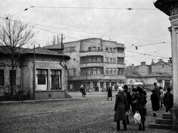
Today, Piața Muncii, in Sector 2, means, for most Bucharesters, a large intersection seasoned with a road underpass, a metro station, and several minutes during which the traffic lights contemplate the human condition. Its official name, Eudoxiu Hurmuzachi Square, appears on maps and in City Hall documents, but everyday conversation prefers the old name inherited from the communist era. With all due respect to Mr Hurmuzachi—an Austrian politician and 19th-century Romanian patriot—nobody brings him up when talking about Piața… Muncii.
But beneath both names lies one that is even older, far more expressive and stubbornly alive: Bariera Vergului.
This was once where Bucharest ended to the east. Beyond it lay fields, gardens, vineyards, and roads travelled by carts heading towards the surrounding villages or Pantelimon. On the city side stood the mahallas, shops, taverns, trams, and that eternal species of Bucharester who knew exactly where to find a shortcut. The barrier was a fiscal border, a geographical landmark, and a meeting place. It was a gateway into the city, with less solemnity than a fortress gate and considerably more merchandise hidden beneath the hay.
Where Bariera Vergului Was Located
Its location can be established beyond doubt. Bariera Vergului corresponds to the square at the junction of Mihai Bravu Road, Calea Călărașilor, Basarabia Boulevard, and Decebal Boulevard. The Bucharest Municipality Museum identifies the site with present-day Piața Muncii and includes it in the old chain of barriers associated, during the 19th century, with the capital’s first circular thoroughfare.
The word “barrier” had a very concrete meaning. Guard posts operated at the ends of the main roads, where people and vehicles were inspected and goods brought into the city were subject to excise duties. In his book Bucharest in the Old Kingdom, George Costescu describes the day and night watchmen and the colourful uniforms of the municipal guards. Bucharesters called them “spirtari,” because spirits occupied a central place in their fiscal concerns. The local authorities had already discovered an enduring truth: wherever there is brandy, a form will soon appear.
Carts loaded with straw or hay were inspected using a long iron rod, which was thrust into the load from several directions. The method was intended to uncover hidden merchandise and spared the guards from having to unload the entire cart. Entering Bucharest, therefore, often began with a vigorous inspection of the animal feed—a procedure that probably made for a memorable morning for both the carter and the horse.
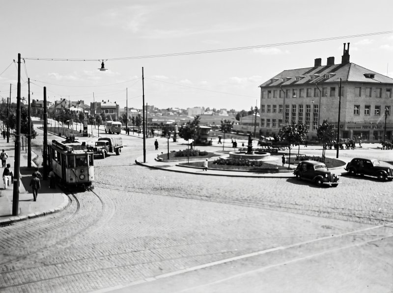 Bariera Vergului in the 40s. On the right side, „Iuliu Meinl”, the biscuit factory
A Name Inherited from Vergu Vartolomei
Literature about Bucharest repeatedly cites 1777 as the year in which Bariera Vergului, or the area bearing this name, was first recorded. Published documents about the city show, however, that the Vergului mahalla already existed in the 18th century, while a reference from 1766 mentions a shop connected to one of the neighbourhood’s residents. The most cautious formulation therefore retains 1777 as the established reference point for the barrier while placing the emergence of the place name in a slightly earlier context.
The name most probably originated with Vergu Vartolomei, a boyar from the reign of Constantin Brâncoveanu. Church sources describe him as a man whom the ruler entrusted with diplomatic missions to Constantinople. In 1724–1725, Vergu Vartolomei, Metropolitan Daniil of Ungro-Wallachia, and Ancuța founded the church that now stands on C. F. Robescu Street, known as Saint Mina–Vergu.
Bucharest place names often operated with admirable economy. A boyar would build a church, own land, or become a landmark within a community, and from there his name would begin to circulate through the mahalla, then through official documents, along the street, and on the lips of coachmen. Vergu thus went from being a person to becoming a place, from a place to a road, and from a road to a… barrier. More than three centuries later, the name still crops up in conversations about the neighbourhood—a genuine marketing achievement that many brands with substantial promotional budgets might regard with understandable envy.
Podul Vergului, the Road That Began in the Heart of the City
Leading from the centre towards the barrier was Podul Vergului, the thoroughfare known today as Calea Călărașilor. In the language of old Bucharest, the word pod, meaning “bridge,” referred to an important street paved with wooden beams. The timber made it easier to travel through the mud, although it also gave the city an expensive and noisy relationship with road maintenance.
Historian Emanuel Bădescu notes that the thoroughfare was called Podul Vergului before 1878 and sometimes appeared under the name Drumul Pantelimonului, because it led towards the gate of Pantelimon Monastery. After the Romanian War of Independence, the name Calea Călărașilor was adopted in honour of the cavalry troops. The change lent a patriotic ring to a street that continued performing the same practical task: carrying people, animals, and goods between the city centre and its eastern outskirts.
Along its route stood mahallas formed around churches, merchants’ houses, workshops, and gardens. At the end of the 19th century, Hala Traian would provide the area with a modern commercial hub, while the old road leading out of the city gradually became a densely built urban thoroughfare. Bucharest advanced into the fields at a familiar pace: first came the road, then the shop, then the house, and finally the argument about traffic.
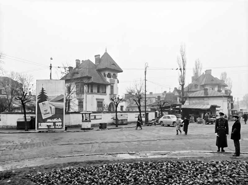 Bariera Vergului, in the 60s / Caption from YouTube channel Constantin Stăncescu
How the Edge of the City Became a Ring Road
The plan drawn up by Vladimir Blaremberg in 1842 shows barriers positioned at the ends of the main roads. After 1860, the peripheral roads began to connect in sections, and by 1871 they already formed a continuous circular line. The Bucharest Municipality Museum regards it as the city’s first ring road.
In the north and east, the route connected Bariera Mogoșoaiei, located in today’s Victory Square, with the barriers of Herăstrăului, Mândritului, Moșilor, Iancului and, finally, Vergului. Iancu de Hunedoara, Ștefan cel Mare, and Mihai Bravu roads preserve much of that peripheral geometry in the contemporary city. Today’s inner ring road is, essentially, the remnant of an old boundary that Bucharest swallowed with considerable appetite.
In 1871, vineyards, cultivated land, and the first industrial sites stretched beyond these roads. On the inner side lay mahallas such as Iancului, Delea Veche, and Delea Nouă. Bariera Vergului marked the point where the compact city dissolved into a mixed landscape of households, gardens, and country roads. The border had an administrative outline, but life passed through it in both directions, every day, on wheels covered in dust.
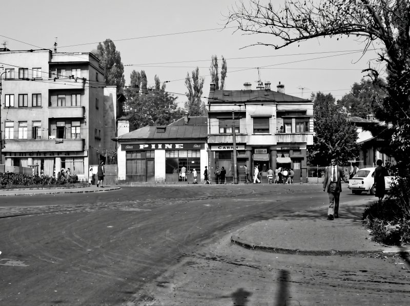 Bariera Vergului during the redevelopment works. / Photo via: Bucurestiul meu drag
Ivașcu Garden and the Pleasures of the Outskirts
The outskirts of Bucharest offered ample room for leisure, and Bariera Vergului had its own recreational destination. Nearby stood Ivașcu Garden, a particularly popular spot during Easter. Sources describing the old gardens of Bucharest mention grilled pastrami, wine drunk from new clay pots, and the custom of cracking painted eggs against one another.
The image says quite enough about how Bucharesters negotiated their relationship with nature. They went out to enjoy the greenery, set up their table, placed the meat on the grill, and turned the field into an extension of their living room—only with more smoke and neighbours selected entirely by chance. A picnic? Yes. We could call it that. But as the city expanded, the garden was gradually taken over by houses and streets.
Commercial activity also grew around the barrier. Merchants and market gardeners from nearby settlements brought vegetables, fruit, milk, and cheese, while the shops and taverns served local residents, travellers, and carters. The barrier began to function as an exchange zone between the surrounding rural economy and the urban market. This was where the rhythm of the village met the appetite of the city—two forces that have always worked splendidly together whenever pastrami appeared on the table.
The Trams and Cinema Vergu
During the interwar period, the area still retained the atmosphere of the outskirts, even though public transport had linked it ever more closely to the rest of the capital. Philologist Gheorghe Parusi, who grew up in the neighbourhood and wrote the excellent book Bariera Vergului or the Life of a Bucharest Boy, recalls that, around 1948, tram 19 terminated here and travelled as far as Chibrit, line 25 ran towards Panduri, and tram 26 connected Vitan with the North Railway Station.
The network turned the barrier into a transport hub with a surprisingly wide reach. A place that had once marked the end of Bucharest now provided connections to the western and northern parts of the city. The tram was thus fulfilling one of its great historic missions: transforming the outskirts into a neighbourhood and distance into routine.
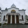
This was also the location of the Vergu Athenaeum and Cinema, housed in an interwar building with its name displayed prominently on the pediment. After the communist regime came to power, the venue was renamed Cinema Munca. The building remained one of the intersection’s few surviving historic landmarks, and its façade still bears the Vergu name with discreet elegance, like a signature left on the wall before the new nomenclature arrived carrying its bucket of paint.
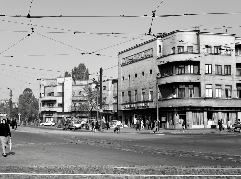 Vergu (Munca) Cinema / Photo via: Bucurestiul meu drag
Barbu Delavrancea, the Boy from Delea Nouă
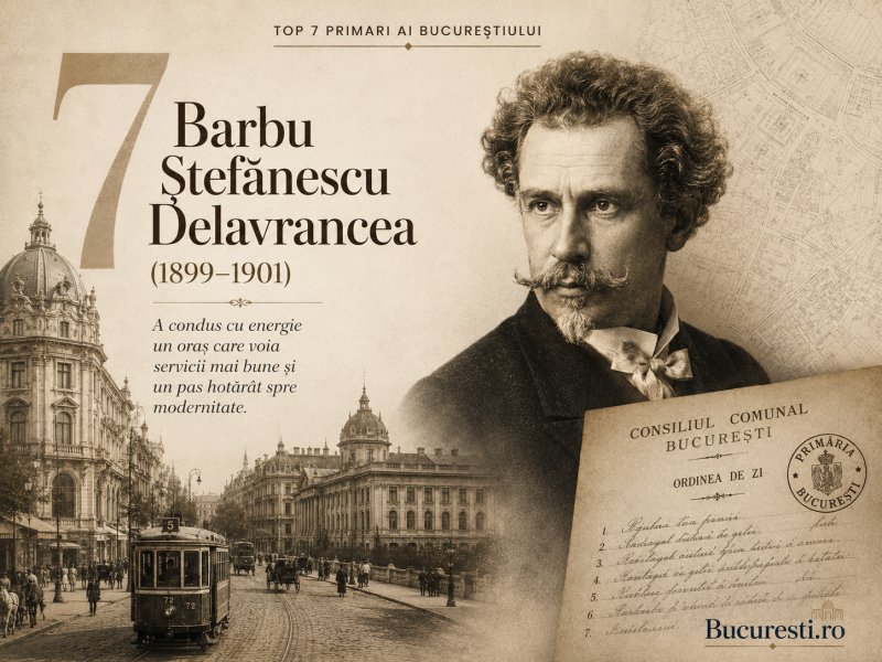
The Bariera Vergului area also appears in the biography of Barbu Ștefănescu Delavrancea. The writer was born on 11 April 1858 and spent his childhood in the Delea Nouă mahalla, located near the barrier. His father, Ștefan Tudorică Albu, was a grain carter—a profession perfectly connected to the world of roads and merchandise passing through the outskirts of the capital.
Delavrancea would go on to become a writer, lawyer, orator, member of the Romanian Academy, and mayor of Bucharest. His journey from the Delea Nouă mahalla to the heart of Romanian public life is one of those biographies that a city produces by mixing ambition with geographical accident. The barrier became the backdrop to the childhood of a man who would eventually govern, for a time, the entire city lying beyond it. Because Delavrancea was—although few people know it—mayor of Bucharest between 1899 and 1901.
From Bariera Vergului to Piața Muncii
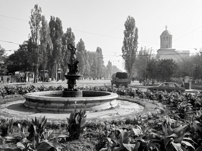 Piața Muncii, 1978. / Photo: Alfredo Padron (via Andrei Bîrsan - Bucurestiul meu drag)
The communist regime replaced the old name with Piața Muncii, or “Labour Square,” while present-day Basarabia Boulevard was likewise renamed Bulevardul Muncii, or “Labour Boulevard.” The choice reflected the symbolic vocabulary of the era, populated by factories, workers’ collectives, and social classes elevated to the status of postal addresses. The name became so firmly established in everyday usage that it survived the official renaming that followed 1990.
The physical transformation of the area was far more radical than the changing of its street signs. Communist urban redevelopment widened major roads, erected continuous rows of apartment blocks, and altered the old street alignments. During the 1980s, the construction of the road underpass and other infrastructure projects led to the demolition of several corner buildings and the remodelling of the intersection. A pharmacy well known to local residents, housed in an old building on one of the corners, disappeared during the works. So did a doughnut shop and several other familiar landmarks.
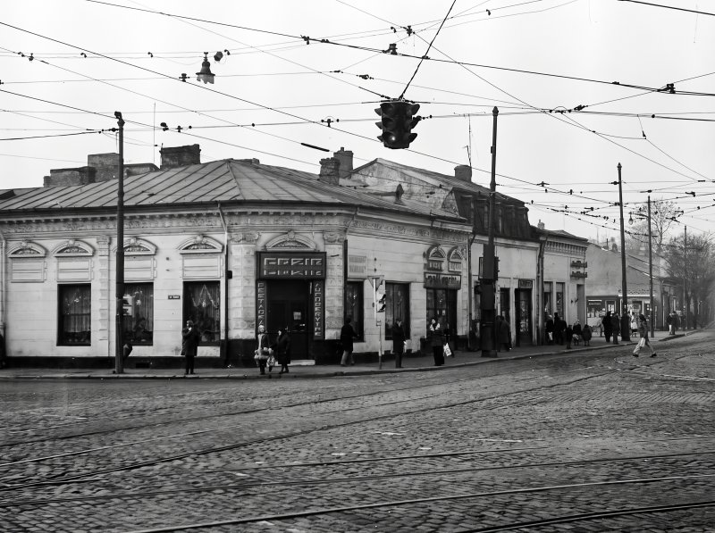 Calea Călărașilor before redevelopment works / Photo: Dan Vartanian
Piața Muncii metro station opened on 17 August 1989, together with the Gara de Nord 1–Dristor 2 section. The city had thus placed its underground railway directly beneath its former eastern gateway. The carts searched with iron rods, the neighbourhood trams, and the underground trains all belong to the same historical thread, even though every generation has been convinced that it was the one that invented congestion.
Eudoxiu Hurmuzachi Square and the Memory That Refuses to Obey Street Signs
After 1990, the square was officially named after the Bukovinian historian and politician Eudoxiu Hurmuzachi. City Hall documents use this name, while the metro station, the road underpass, and everyday speech retain the name Piața Muncii. Bariera Vergului survives in a more affectionate register, somewhere between urban history, family memory, and old photographs.
The overlap of these three names tells the story of Bucharest with almost comical precision: the authorities decide, public transport preserves, and residents choose according to habit and what sounds right. At the same intersection, a boyar from the age of Brâncoveanu, a communist ideal, and a Bukovinian historian are all crammed together, forced to share the same traffic light.
The physical barrier has vanished, the fields have been pushed far beyond the city, and what was once its outskirts has become a busy urban hub. Yet the old shape can still be traced in the route of Calea Călărașilor, in the curve of the Mihai Bravu–Ștefan cel Mare ring road, in the former Cinema Vergu building, and in the way people refer to the place. Bariera Vergului remains one of those vanished addresses that continue to shape Bucharest’s mental map. Sometimes a city loses its buildings more quickly than it loses its vocabulary—and here, the vocabulary has proved remarkably resilient.
The images in this article were restored using AI. The original photographs belong to their respective authors (unidentified unless credited alongside each image).
You may also like: 10 streets in Sector 2 of Bucharest that have interesting stories