The History of the Dudești Neighborhood: Bucharest Between Vineyards, Shops, and Bulldozers
By Eddie Țone
- Articles
- 14 AUG 26
The trouble with the Dudești neighborhood is that everyone recognizes the name, but very few people would draw the same outline on a map. For some, it begins at Hala Traian; for others, at the Vitan Post Office; while for a driver stuck at the Dristor intersection, it probably means that stretch of the city they cross while anxiously checking the time and feeling the car rattle over the rough paving stones. Beneath the asphalt and among the apartment blocks, however, several layers of Dudești lie superimposed, like the pages of a file the capital has carried with it from the Neolithic period to the sweeping demolitions of the 1980s.
The story encompasses a prehistoric settlement that became a landmark of European archaeology, a village connected to a boyar family, a thoroughfare lined with workshops and shops, a vibrant Jewish community, followed by nationalization, decay, and a politically driven construction project that brutally altered the geography of the area. So where does the history of the Dudești neighborhood begin? Long before the tram, the shopfront houses, and even Bucharest itself.
Before the Neighborhood, There Was Malu Roșu
On the southeastern edge of the area, on the low terrace of the Dâmbovița River’s left bank, archaeologists investigated the settlement at Dudești–Malu Roșu. The first excavations were carried out by Dinu V. Rosetti in 1931, and Eugen Comșa resumed systematic research beginning in 1954. The discoveries gave their name to the Dudești culture, one of the Early Neolithic cultures of the region south of the Carpathians. The neighborhood thus lent its name to a world of farmers and animal breeders some seven millennia old—an urban achievement difficult to match even in a city exceedingly proud of the age of the occasional cellar.
The site also yielded a rare discovery. In 1956, researchers found an inhumation grave containing a skeleton placed in a crouched position on its right side. The study published by the Bucharest Municipality Museum describes it as the only grave known in Romania at the time of the research that belonged to the Dudești culture and preserved the bones in anatomical connection. The archaeological research published by the Bucharest Municipality Museum also records the amputation of the right forearm during the individual’s lifetime. Suddenly, the convenient label of “an area of apartment blocks” gains a depth of several thousand years.
Dudești Village and the Road Leading from Bucharest
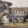
The earliest known documentary mention of Dudești dates from April 29, 1577, alongside Văcărești. In the centuries that followed, the village and estate became associated with the Dudescu boyar family, which had been present in the political life of Wallachia since the time of Michael the Brave. The road leading toward the city gradually took shape and would become Ulița Dudeștilor, and later Calea Dudești. The logic of the name was clear to old-time Bucharesters: the thoroughfare led to Dudești, just as other roads set out toward Moși, Călărași, or Ploiești.
In this respect, the sources preserve two closely connected geographies. The village and estate of Dudești-Cioplea lay farther to the southeast, within the urban fabric now occupied largely by Titan and Balta Albă. The mahalle and Calea Dudești grew outward from the city toward that estate. The name migrated along the road, and Bucharest did the rest, gradually absorbing the spaces between the center and the old village.
Dudești-Cioplea I Church preserves one of the anchors of the old settlement. A place of worship appears on a Russian map from 1770 and in an 1810 census register. The earthquakes of 1802 and 1804 damaged it, and the banker Ștefanache Hagi-Moscu erected the present church in 1820. The parish history speaks cautiously about the site’s earlier origins, and caution suits history well: an archive destroyed in the fire of 1900 took some of the easy answers with it.
A Commercial Thoroughfare Rose from Vineyards and Orchards
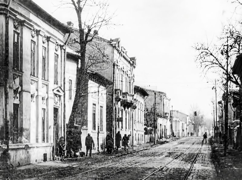
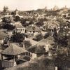
At the beginning of the nineteenth century, the urban section of Dudești still had the air of an almost rural outskirts. Eleonora Cofas’s study, “The Dramatic Fate of a Street—Calea Dudești,” published in 1997 by the Bucharest Municipality Museum of History and Art, provides figures and landmarks drawn from maps, land registers, and research conducted immediately before the demolitions. The mahalle surrounding Holy Trinity Church had 67 houses and 231 residents at the beginning of the century. The 1852 Borroczyn Plan still shows gardens, vineyards, and orchards along the road.
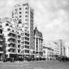
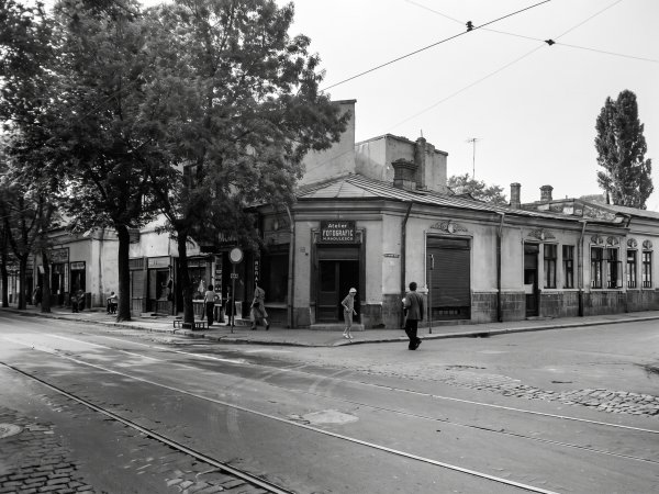
The transformation occurred in the second half of the century. The city grew denser, its street fronts became continuous, and houses with commercial spaces on the ground floor and living quarters behind them or upstairs became commonplace. Of the 58 properties examined by the museum team in 1987, nearly all had been built between 1880 and 1940. The area’s density warranted the introduction of a tram line in 1897–1898, running as far as Holy Trinity Church. Modernity arrived on rails and, in the Bucharest tradition, passed right in front of the shop.
Calea Dudești acquired a remarkable commercial and artisanal character. Pharmacies, butcher shops, bakeries, tailor shops, workshops, cafés, restaurants, and cinemas followed one another almost without interruption. The 1987 documentation identified Romanian, Jewish, Greek, and Italian-owned properties. Within the section studied, 53% of the properties belonged to Romanians, 37% to Jews with Romanian citizenship, and 7% to Greek and Italian owners. These figures refer to the sample of 58 properties and describe one section of the thoroughfare, not the entire population of the neighborhood.
Jewish Dudești, Between Everyday Life and Literature
Dudești formed a continuous urban area with the large Jewish quarter that had developed around Calea Văcărești. Merchants, craftspeople, doctors, salaried workers, and families with widely varying incomes lived here. The image of a neighborhood defined exclusively by poverty—or exclusively by prosperous commerce—misses precisely the mixture that gave it its energy. On the same street stood the modest shop, the pharmacy, the doctor’s office, and the cinema, while their owners referred customers to one another. The social network came complete with a counter, a painted sign, and extended opening hours.
Writer Isac Peltz lived in the neighborhood and transformed the world of the Jewish mahalle into literature. His novel “Calea Văcărești,” published in 1933, follows the life of the area from the beginning of the twentieth century until after the First World War. Peltz came from the modest family of a tailor and knew its courtyards, small businesses, ambitions, and cramped living conditions from the inside. The National Museum of Romanian Literature calls the book the author’s masterpiece, and the verdict is justified: few novels have preserved the social hum of the old Văcărești–Dudești area so vividly.
Another important figure was Dr. Maximilian Popper, after whom the former Trinității Street is now named. Nearby stood Caritas Hospital, a medical institution established by the Jewish community and expanded over time. Until 2011, when its patients were transferred elsewhere, the complex remained a major medical landmark in Bucharest. The surviving buildings now tell the story through their masonry, blind windows, and a considerable amount of administrative melancholy.
Crucea de Piatră, Between Real Landmark and Urban Legend
In popular memory, the name “Crucea de Piatră” (The Stone Cross) became associated with the area’s brothels. The notoriety of this interwar subject grew with every retelling, because Bucharest loves a spicy story, especially when the documents are sitting quietly in an archive. The name, however, originated with a tangible landmark connected to Holy Trinity Church at 81–83 Calea Dudești and the cross in its courtyard.
The church had been built before 1804 by Păun Plugarul and his family, while an 1808 census register also mentions the guild of şalvar makers among its founders. Maps from 1847 and 1852 placed it near the Dudești barrier, where the lane through the vineyards toward Vergu began. A cemetery operated in the courtyard until 1890, and researchers recorded a cross dated April 22, 1842. Barbu Ștefănescu Delavrancea included the church in his novella “Hagi Tudose,” granting it a second life—literary, and far more resistant to earthquakes.
January 1941: The Violent Rupture
Life in the neighborhood was shattered during the Legionnaires’ Rebellion and the Bucharest Pogrom, between January 21 and 23, 1941. The Dudești and Văcărești areas, home to many Jewish residents, became targets of looting, arson, arrests, and murder. The report of the International Commission on the Holocaust in Romania, available through Yad Vashem, describes the attacks on Jewish neighborhoods and the detention and torture centers used by the Legionnaires.
Eleonora Cofas’s study also preserves a local episode. Constantin Mitroi, the owner of the “Întâlnirea Meseriașilor” restaurant at 47 Calea Dudești, is said to have sheltered more than 30 Jews in the rear dining room, according to the recollections of his daughter, Cornelia Mitroi-Constantinescu. The account comes from family testimony recorded in 1987, and it is precisely this detail—with its source plainly identified—that gives a human dimension to a history otherwise at risk of remaining a cold succession of dates.
Nationalization and the Street’s Long Decline
After 1948, commercial properties and homes were transferred en masse into state ownership. The Mitroi family’s restaurant was requisitioned in October 1948, and their home was nationalized in April 1950. The former restaurant housed the “Înfrățirea” confectionery until 1984—a name expressing almost athletic optimism for premises obtained through confiscation.
The pattern was repeated along the thoroughfare. In 1987, of the 58 buildings studied, 45 belonged to the state, five had mixed ownership, six remained privately owned, and two belonged to parishes. Limited investment, changes of use, and overcrowding accelerated their deterioration. Then came the circular argument so useful to sweeping demolition projects: buildings allowed to decay became proof that the area deserved to be replaced.
Nevertheless, old Dudești still retained a coherent urban structure, with human-scale eclectic buildings, courtyards, shops, and workshops. Its value came from the ensemble and from the continuity of everyday life—a category difficult to fit into a systematization chart. One modest façade might appear expendable; fifty such façades made a street.
1987: The Year the Map Was Cut with a Ruler
In the summer of 1987, a team from the Bucharest Municipality Museum of History and Art was assigned to document the first section of Calea Dudești and the neighboring streets before their demolition. The researchers photographed houses, completed property records, consulted land registers, and interviewed residents while the bulldozers advanced—a rare undertaking in which museum specialists were given the opportunity to study heritage at the same pace at which it disappeared.
The area between the old Calea Dudești, the Vitan Post Office, and the adjoining streets was to make way for the development known as “Victory of Socialism III.” The plans called for Holy Trinity Church to be preserved, but the building was demolished on October 9, 1987. Parishioners and priests had organized a vigil around it in the hope of stopping the operation. The decision prevailed, as it so often did in the Bucharest of that decade whenever hope encountered the five-year plan.
The old continuity of Calea Dudești toward the city center was broken, while Unirii and Octavian Goga boulevards, together with the new apartment-block developments, redrew the area. Part of the street network disappeared completely; other fragments were left isolated and now seem devoid of logic. The logic exists, but it belongs to an erased map.
What Remains of Dudești
Calea Dudești survives east of the demolished area, from its connection with Octavian Goga Boulevard toward Mihai Bravu Road, where the route continues along Camil Ressu Boulevard. Streets such as Maximilian Popper, the buildings of the former Caritas Hospital, and a handful of houses and plots preserve fragments of the historic neighborhood. Holy Trinity Church was rebuilt on Burebista Boulevard, in a different form and at a different location—a sign that urban memory sometimes finds a new address, even when the old one has vanished.
Beyond the surviving monuments, Dudești’s legacy lies in the way the city carries its ruptures. Today, the neighborhood’s name connects a Neolithic site, a medieval village, a boyar family, a commercial thoroughfare, Jewish memory, and the trauma of demolition. That seems a lot for two syllables and a plural ending. Bucharest, however, frequently works with such containers: it places several centuries inside the name of a tram stop, then acts surprised when the story spills over.
You may also like: The history of Dristor neighborhood: from the Dudești estate to the arrival of the Bulgarians and today’s area