10 Things You Didn’t Know About Northern Bucharest
- Articles
- 06 NOV 26
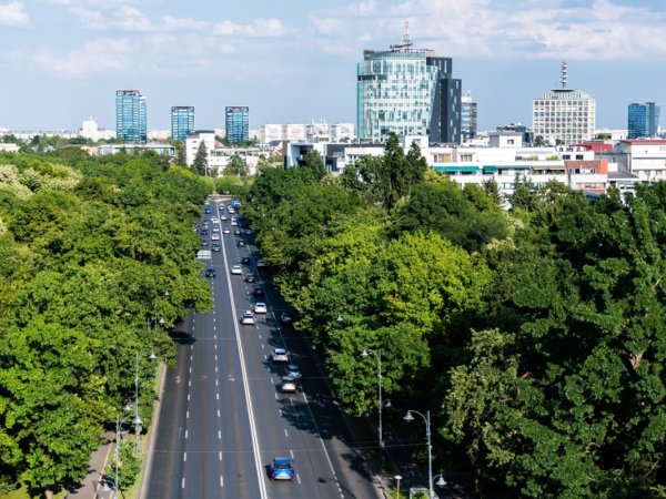
Northern Bucharest is now associated with wide boulevards, residential neighborhoods, office buildings, restaurants, parks, and some of the most expensive areas of the capital. Herăstrău, Dorobanți, Primăverii, Băneasa, Floreasca, and Șoseaua Nordului are names that immediately evoke a modern, prosperous, and cosmopolitan Bucharest. In reality, this part of the city has a much older and more complex history than its contemporary image might suggest. For centuries, northern Bucharest was a peripheral area, characterized by villages, estates, country roads, forests, and marshlands. Its transformation into one of the most important urban areas of Bucharest took place gradually, particularly from the 19th century onward, accelerating during the interwar period. Lakes were developed, roads were turned into modern thoroughfares, parks, villas, and institutions appeared, and after 1950 the city pushed its boundaries even farther north. Here are ten lesser-known facts about this part of Bucharest.
1. “Northern Bucharest” is not an official administrative area
The first important thing to clarify is that “Northern Bucharest” is not an official administrative unit. It is rather a geographical and urban term used to describe a group of neighborhoods and areas located in the northern part of the capital. Depending on the context, it can include Băneasa, Herăstrău, Aviatorilor, Dorobanți, Primăverii, Floreasca, Tei, Dămăroaia, Străulești, and other areas.
Moreover, what is commonly perceived as “Northern Bucharest” extends beyond the administrative boundaries of the municipality. Pipera, for example, is frequently associated with the northern part of the capital, although it is actually located in the city of Voluntari, Ilfov County. This confusion is understandable given the economic and real-estate development of the entire area, which today functions almost as a continuous urban space.
2. The northern part of the city was once a rural-looking outskirts
It is difficult to imagine today, when looking at Șoseaua Kiseleff, Charles de Gaulle Square, or Șoseaua Nordului, that a significant part of this territory once had a rural character. Historical documents show that northern Bucharest developed for a long time on the outskirts of the city, while Băneasa, Herăstrău, and other settlements in the area had the status of suburban communes.
During the interwar period, Bucharest's administration attempted to control and organize this expansion. A study published by the Museum of the Municipality of Bucharest shows that, through the urban plans developed in the 1930s, Băneasa, Mogoșoaia, and Herăstrău were among the suburban communes of the capital. After 1950, another stage of urban expansion resulted in important territories in the north being incorporated into the city's built-up area.
3. Șoseaua Kiseleff once crossed a much emptier landscape
One of Bucharest's most elegant avenues, Șoseaua Kiseleff, has a history that began in a landscape very different from the one we know today. The area between the barrier of Podul Mogoșoaiei and Băneasa Forest was once described in historical documents as an open plain, lacking the rich vegetation that we now associate with the northern part of the city.
The route was initially known as “Aleea Băneasa”, and the first references to its existence and to the plantations along the road date back to the 18th century. During the first half of the 19th century, the avenue was improved and planted with trees, gradually becoming one of the main access routes toward the north.
4. The lakes in the north are connected to the Colentina River
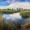
The present-day landscape of northern Bucharest cannot be separated from its lakes. Băneasa, Herăstrău, Floreasca, Tei, Plumbuita, and other lakes are part of the system of water-management works along the Colentina River, and their existence had a decisive influence on the development of the city.
The northern area was crossed by the meandering course of the Colentina and contained numerous ponds and marshy areas. During the interwar period, extensive hydraulic works transformed these territories into recreational areas and made the development of new neighborhoods and parks possible. Lake Băneasa, for example, was developed as part of drainage and water-management works carried out in the 1930s, while Herăstrău became the centerpiece of one of the capital's most important parks.
5. Herăstrău Park was developed on marshland
Today's King Michael I Park, known for generations of Bucharest residents as Herăstrău, is one of the most spectacular examples of urban transformation in the northern part of the capital. Before it was developed, the area was largely marshy and difficult to use for urban development.
The drainage and landscaping works carried out during the 1930s radically changed the landscape. The park was officially inaugurated on May 9, 1936, during the “Bucharest Month” celebrations. Over the decades, the park had several names, including Carol II Park, National Park, and, during the communist period, I.V. Stalin Park. In 2017, it officially received the name King Michael I Park.
6. Northern Bucharest is home to a “village” brought together from all over Romania
One of the most remarkable institutions in northern Bucharest is the Dimitrie Gusti National Village Museum. Its concept was unusual for the 1930s: traditional homes, houses of worship, and rural installations were brought from different regions of the country and reconstructed near Lake Herăstrău.
The museum was officially inaugurated on May 10, 1936, in the presence of King Carol II, and opened to the public several days later. In its first phase, the museum covered 4.5 hectares and contained 33 authentic complexes. Thus, an area on the outskirts of Bucharest became a place where visitors could experience, in a single walk, the diversity of the Romanian village.
7. Băneasa has a history connected to the pioneers of aviation
Băneasa Airport is one of the oldest institutions in northern Bucharest and has a direct connection to the beginnings of Romanian aviation. The first flights over the Băneasa grounds were recorded as early as 1909, when Louis Blériot flew his aircraft over the former racetrack.
On August 1, 1912, the Romanian Air League, led by Prince George Valentin Bibescu, established a flying school here. The airport subsequently became an important center for both civil and military aviation. In 1920, the Franco-Romanian Air Navigation Company was established, while in 1922 Băneasa was included on one of the first international air routes connecting Europe with Constantinople, with a stop in Bucharest.
8. Băneasa Royal Railway Station was built for official receptions
Near the airport and the Minovici Museum lies another lesser-known landmark of northern Bucharest: Băneasa Royal Railway Station. The building was erected in 1936 according to plans by architect Duiliu Marcu and had a special purpose.
It was not an ordinary railway station, but a space intended primarily for official receptions involving the Royal Family and foreign delegations. Its architecture and interior were designed specifically for such ceremonies, and the Museum of the Municipality of Bucharest notes the existence of an elegant reception hall featuring wooden paneling and marble floors.
9. Băneasa Forest is a remnant of a much larger wooded landscape
When Bucharest residents think of Băneasa Forest, they tend to picture a green oasis on the edge of the city. In reality, it is only part of what remains of a much larger forest landscape that once covered extensive areas of the Wallachian Plain.
The forest also played an important role in the interwar development of recreational projects for Bucharest. Documents from the period reveal the administration's interest in creating a green belt around the city, with Băneasa among the main recreational areas. At the same time, the forest still marks one of the capital's important natural boundaries to the north.
10. Northern Bucharest has evolved from an outskirts area into an economic center
Perhaps the most spectacular transformation is the one that has taken place over the past few decades. An area that once had a rural or peripheral character has become one of the most dynamic parts of Bucharest. Floreasca, Barbu Văcărescu, Pipera, Băneasa, and the Aviatorilor area have attracted office buildings, corporate headquarters, hotels, restaurants, and residential developments.
The transformation did not happen overnight. It began with major interwar urban projects, continued through the investments and urban-planning changes of the communist period, and accelerated after 1990. Today, northern Bucharest combines lakes and forests, former villages, historic buildings, airports, parks, villa districts, and modern business centers within a relatively compact area.
Seen from this perspective, northern Bucharest is not simply the prosperous area we know today. It is the result of an urban transformation that unfolded over more than a century. From roads crossing fields and estates to crowded boulevards and business centers, from the marshlands of the Colentina to Herăstrău Park, and from the first aircraft flown by Blériot to Băneasa Airport, the history of northern Bucharest is ultimately the story of the capital's modernization.
We also recommend: The story of the Aviației neighborhood in Bucharest, the area built for the Băneasa Airport pilots